
Description
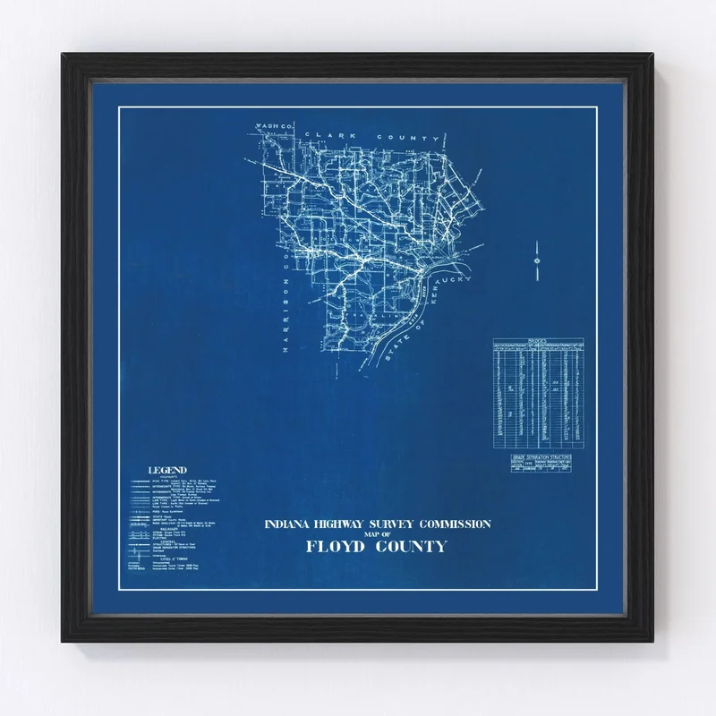
Discover a piece of Indiana’s past with our beautifully restored vintage map of Floyd County, originally drawn in 1936. This map is not just a stunning work of art—it’s also a gateway to the history and spirit of the area. Whether it’s New Albany’s rich history or the charming appeal of Georgetown, this piece makes for an excellent gift for anyone who appreciates local heritage and classic decor.
Our prints boast high-quality craftsmanship, with frames constructed by hand from solid wood and stained to perfection. The canvas versions are mounted meticulously on solid wood stretcher bars using durable polycotton material, while unframed variants come printed on high-grade matte paper for a sleek finish. Ready to hang straight from the box, this timeless decor is ideal for complementing any home or office setting.
Perfect as both an eye-catching conversational starter and tribute to local lore, this map will surely be treasured by history enthusiasts and residents alike as it captures Floyd County’s unique character through its most notable landmarks.


Reviews
There are no reviews yet.