
Description
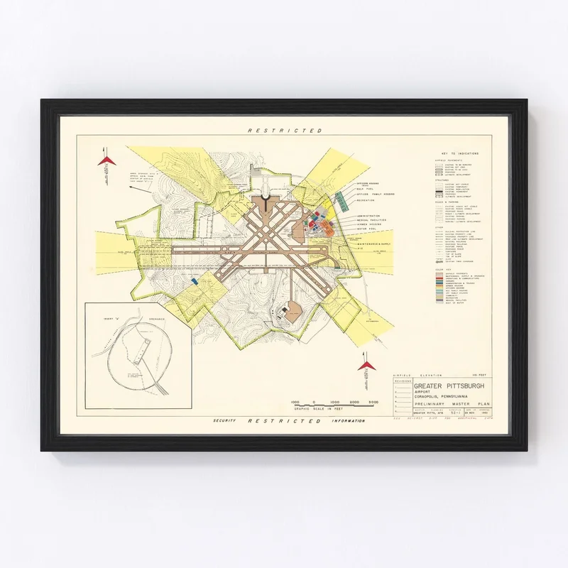
Discover a piece of history with our vintage map print of Coraopolis, dating back to 1951. This beautifully restored map captures the essence of Allegheny County, Pennsylvania, and makes for an intriguing addition to any home or office decor. Whether you’re a local history enthusiast or just appreciate timeless elegance, this print is sure to spark conversations.
Each print is crafted with exceptional quality materials by hand—offering options in either solid wood frames with a tasteful stain or unframed on high-quality matte paper. The framed versions arrive ready to hang out of the box, providing convenience without compromising style. For those who prefer canvas prints, they’re handcrafted using durable polycotton material stretched over sturdy wooden bars.
This vintage map isn’t just decor; it’s a journey into the past that glorifies local heritage while suiting modern tastes. Perfect as a thoughtful gift for anyone keen on regional history or as your next conversation starter in any space!
Reviews
There are no reviews yet.