
Description
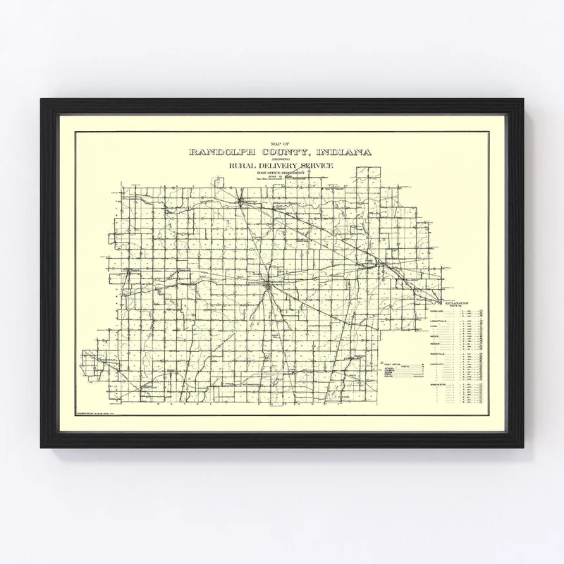
Rediscover the charm of early 20th century America with this beautifully restored 1910 map of Randolph County, Indiana. Known for its historic towns like Winchester, Union City, and Farmland, this vintage piece celebrates local heritage and adds a touch of history to any setting.
This map is more than another wall hanging—it’s a conversation starter that brings stories from the past into your home or office. Crafted with precision, each print is constructed by hand. If you opt for one of our framed versions, you’ll appreciate the rich quality of solid wood frames stained to perfection. Meanwhile, our canvas prints boast polycotton canvas stretched over durable wood bars.
For those who love the finer details without the frame fussiness, choose our unframed prints made on high-quality matte paper. Each printed version arrives ready to hang straight out of the box—a perfect gift for anyone fascinated by local history or looking to bring a slice of Narrated Americana into their personal space.

Reviews
There are no reviews yet.