
Description
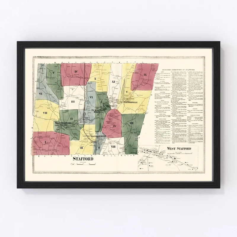
Discover a piece of history with our beautifully restored vintage map of Stafford, nestled in Tolland County, Connecticut. Originally crafted in 1869, this map is a perfect nod to the rich local heritage. Whether you’re drawn to its detailed depiction of Stafford or simply love historical artifacts, this piece makes an excellent addition to any home or office.
Our prints are crafted with care using high-quality materials. Choose from solid wood frames for a classic finish or opt for unframed prints on premium matte paper for a sleek look. If you prefer canvas, you’ll appreciate our hand-made polycotton canvas stretched over robust wooden bars.
This vintage map not only adds charm but also sparks engaging conversations among guests. As soon as it arrives at your door, it’s ready to hang and admire right out of the box—a thoughtful gift idea for history buffs and lovers of local stories alike.
Reviews
There are no reviews yet.