
Description
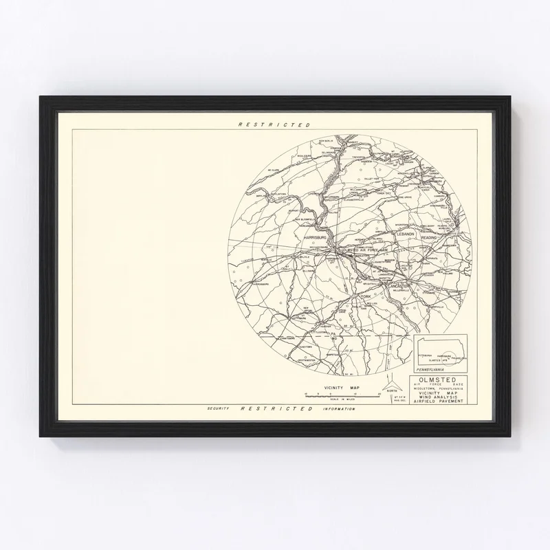
Discover a piece of history with our beautifully restored vintage map of Middletown, nestled in Dauphin County, Pennsylvania. Originally crafted in 1951, this map captures the charm and detail of yesteryear, making it an ideal gift for those who cherish local history. Whether you’re decorating your home or office, its traditional yet classy appeal fits seamlessly into any space.
Each print is ready to hang right out of the box, promising both convenience and timeless style. Our frames are crafted by hand from solid wood and thoughtfully stained to enhance their natural elegance. If you prefer canvas prints, these are hand-stretched using polycotton canvas over sturdy wood bars to ensure durability and a refined finish. For those who want something more versatile, our unframed prints shine on high-quality matte paper.
This map doesn’t just serve as decor; it’s a conversation starter that celebrates Middletown’s rich heritage within the United States. Own a piece of history that is not only visually stunning but also invites exploration into past times.

Reviews
There are no reviews yet.